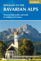
Walking in the Bavarian Alps

|
 |
Descrizione |
A guidebook to 70 graded walks and treks in Germany’s Bavarian Alps. Exploring the beautiful scenery of the German-Austrian border between Lake Constance and Berchtesgaden, the routes are suitable for all abilities and are perfect for walking April through October.
The day walks range from 7-22km (4-13 miles) and can be enjoyed in 3-11 hours. The multi-day treks cover 27-400km (17-249 miles) and include the red and purple trails on the Bavarian section of the Via Alpina.
1:100:000 maps are included for each route
GPX files available to download
Detailed information on planning, accommodation and amenities
Highlights include Germany's largest ice cave (Schellenberg) and its highest mountain, the Zugspitze
Information given on local culture and wildlife
|